The Evolution of Drone Surveying in Sydney
In recent years, drone services in Sydney have transformed how we approach surveying and mapping. Traditionally, land surveying relied on manual labor and ground-based equipment, which was time-consuming and often imprecise in difficult terrain. Today, drone technology has revolutionized this process by offering fast, accurate, and cost-effective solutions, especially when paired with advanced tools like Photogrammetry and LiDAR.
With the rise of professional drone pilots, these technologies have become more accessible and widely used across industries such as construction, mining, agriculture, and environmental conservation. Drone surveying can cover vast areas with pinpoint accuracy, offering a more comprehensive understanding of the land.
Understanding Drone Photogrammetry: Capturing Data with Precision
Photogrammetry, a core element of modern drone surveying, uses aerial imagery to generate precise maps and 3D models of terrain. The process involves flying drones equipped with high-resolution cameras over the target area, capturing a series of overlapping images. These images are then processed using specialized software to create a detailed 3D representation of the landscape.
Drone services Sydney that specialize in photogrammetry offer unparalleled accuracy in their data collection, making them invaluable for architects, engineers, and urban planners. The ability to survey large areas quickly and efficiently means that projects can progress faster, and with fewer risks of human error.
The Power of LiDAR: A New Era of 3D Mapping
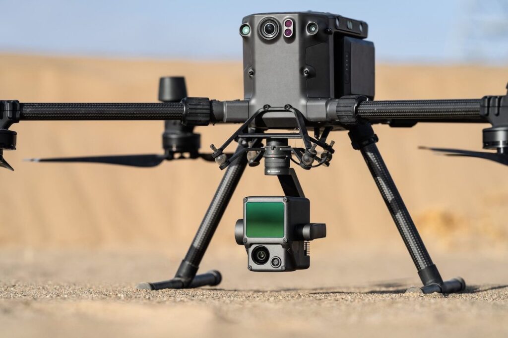
LiDAR (Light Detection and Ranging) is another groundbreaking technology employed by drone pilots in Sydney. Unlike photogrammetry, which relies on visual data, LiDAR uses laser pulses to measure distances from the drone to the ground. These pulses are then used to create highly accurate topographic maps, even in areas with dense vegetation or other obstacles that might obscure the view from traditional cameras.
LiDAR is especially valuable for industries that require precise elevation data, such as flood risk assessment, forest management, and construction planning. It can penetrate foliage, allowing surveyors to map the ground beneath trees and dense cover, making it an ideal solution for remote or heavily forested areas.
Drone Services in Sydney: Efficiency and Cost-Effectiveness
One of the main reasons that drone services in Sydney are becoming so popular is their ability to provide cost-effective solutions. Traditional surveying methods require large teams, expensive equipment, and a significant amount of time to complete. In contrast, drone technology allows for faster data collection and processing, meaning that companies can receive detailed surveys in a fraction of the time it would take using older methods.
For businesses, this translates into significant cost savings and allows for more frequent surveying and monitoring of projects. The flexibility and versatility of drones also mean that drone pilots can access hard-to-reach areas that would otherwise be difficult or impossible to survey with traditional tools.
Applications of Drone Surveying: From Construction to Agriculture
The applications of drone surveying are vast, and drone services in Sydney are utilized in a wide range of industries. In construction, drones can be used to monitor the progress of a project, track materials, and ensure that everything is proceeding according to plan. Photogrammetry and LiDAR data can also be used to create accurate models of building sites, helping engineers to visualize the terrain and identify any potential challenges before construction begins.
Conclusion
As technology continues to advance, the future of drone survey in Sydney looks incredibly promising. With the integration of artificial intelligence, machine learning, and real-time data processing, the capabilities of drone services in Sydney will only continue to expand. In the coming years, drones could become an even more integral part of industries ranging from urban development to environmental conservation. For businesses looking to take advantage of these cutting-edge solutions, investing in drone pilots and services is not just a smart move—it’s essential for staying competitive in an increasingly tech-driven world. For expert drone surveying and cutting-edge technology like Photogrammetry and LiDAR, visit highexposure.com.au to explore professional services that meet your needs.